Inspired by the painted ceilings in the Polar Museum‘s entrance hall, the Polar education team wanted an updated version of our Arctic map that we could touch, explore and get close to.
In the Autumn of 2016, we commissioned local artist Jenny Langley to make us a textile map of the region that also incorporated current Arctic research. Jenny worked throughout the winter, and in February a group of staff, students and volunteers spent an evening adding their stitches to her work.
In April the Arctic map was delivered…
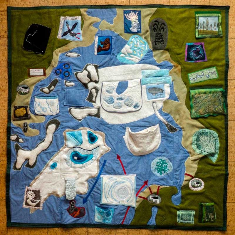
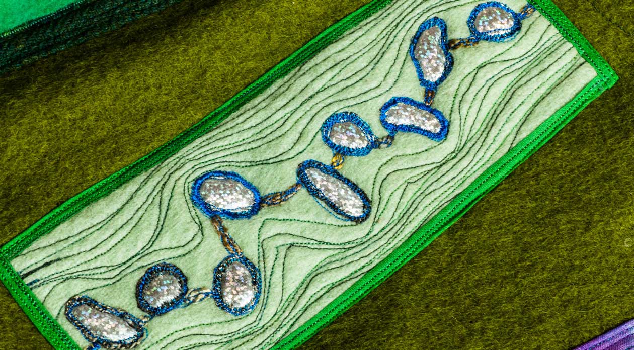
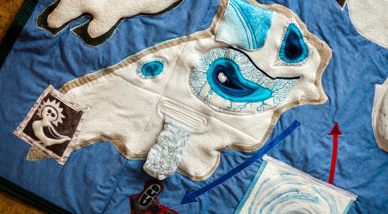
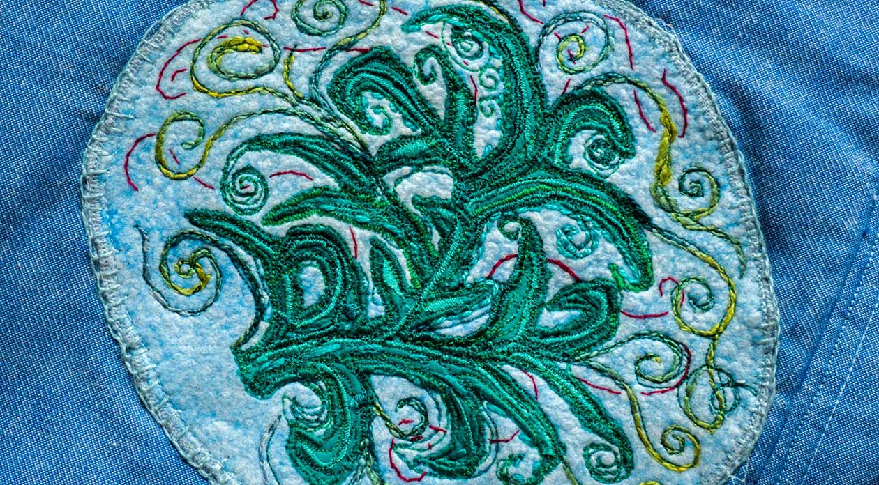
As expected, it is exquisite. The map showcases the research of the Scott Polar Research Institute in 3D. Flaps can be lifted to reveal a submarine hidden under the ice, sun dogs, pollution, shipwrecks and islands that don’t exist. There is a retreating glacier and a polar bear cave, complete with sleeping bears, and numerous pockets to store additional items. All of this is set against a backdrop of a changing treeline and shifting sea currents- just some of the hints of climate change observed by our researchers.
So now we have both the Arctic and the Antarctic depicted in textiles. Each map shows the current research and highlights how different each region is.
Already the Arctic map has been enjoyed by our younger visitors as part of a Little Explorers storytelling session. Visiting scholars, teacher trainees and even a group of MPs and Peers have also seen the map.
Despite the great excitement amongst staff there was also some sadness. Over tea colleagues were pondering the completion of both maps; ‘What are we going to stitch next?’ Quickly, one of the PhD students responded, ‘How about the third pole, the Himalayas!’
Photographs of the textile map were taken by Derek Langley.